
PaveSight: AI Infrastructure
& Surface Monitoring
PaveSight AB is a Swedish infrastructure technology company providing AI-driven surface condition monitoring and automated scanning. Headquartered in Karlskrona, PaveSight deploys vehicle-mounted stereoscopic vision arrays and real-time edge compute systems to detect potholes, rutting, and surface degradation. Our data collection methodology strictly aligns with Sweden’s official SKR standard handbook, 'Bära eller brista'.
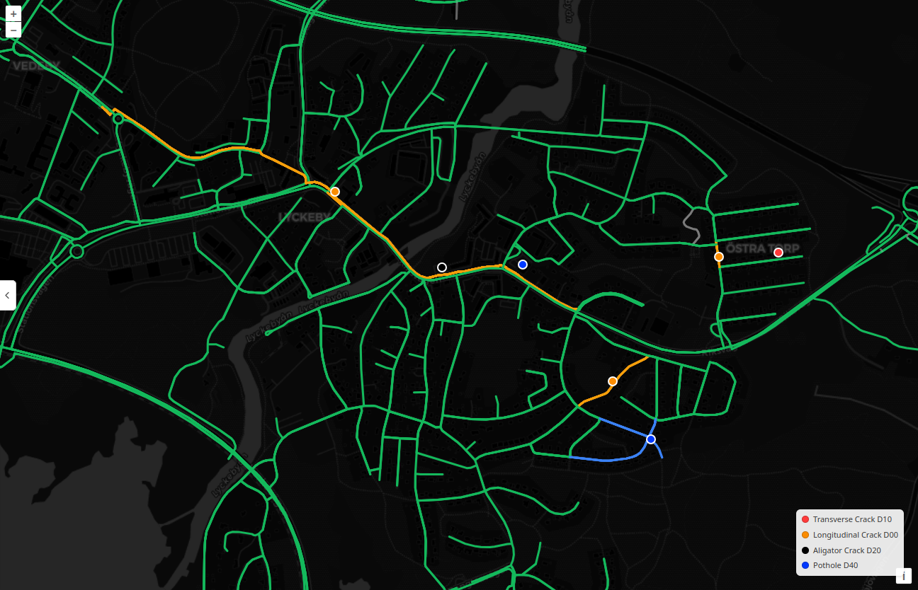
Real-Time Detections & Segment Analysis
Transforming raw vehicle telemetry into actionable, customizable surface health intelligence.
Tailored Infrastructure Intelligence & Comprehensive Maps
PaveSight delivers surface condition data that can be dynamically filtered as needed using our unique metadata capture, such as querying "only include potholes deeper than 5cm".
"Bära eller brista" Segment Mapping
We compile aggregated data into a segment map to give users a comprehensive overview of the state of their pavement, delivered as "Bära eller brista" evaluations for efficient maintenance planning.
Instant Individual Detection Inspection
Users can view individual detections allowing for quickly getting the relevant information if an immediate surface repair is in order.
Advanced AI Planning & Office Workflows
Integrated tools for cm-precise measurements, GDPR privacy, and remote repair ordering.
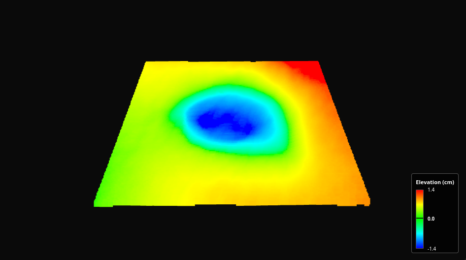
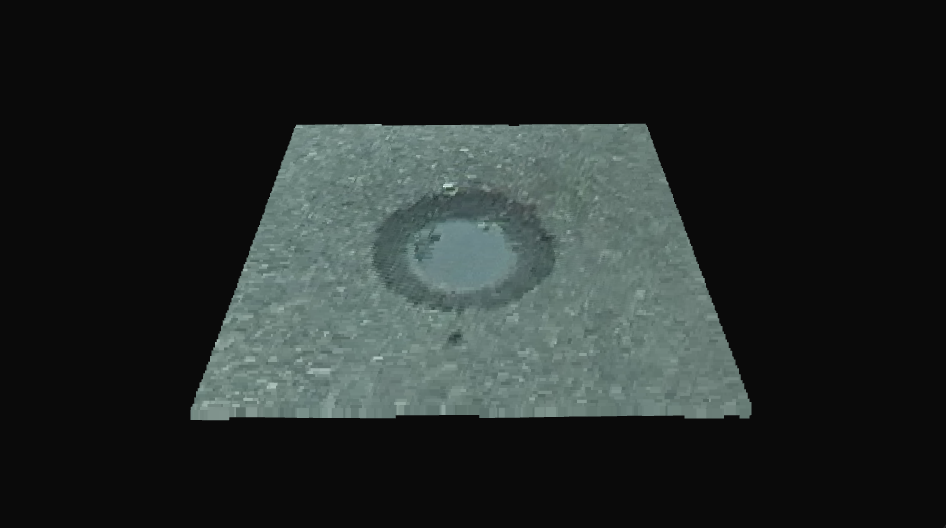
3D Depth Reveal Viewport
Slide to compare 3D optical surface view with cm precision 3D depth heatmap in real time.
On-Edge Detection & Privacy
Your data processed locally from start to finish. Raw video stays on the vehicle, only anonymous road defect metadata is synced.
Automated Planning Assist
Maximize for reduced material usage, priority problem areas, or custom budget targets with automated AI scheduling tools.
Optimizes repair batch size & route density
Zero-Field Repair Ordering
When ordering repairs, our system measures the exact crack area in m² and assigns standard AMA/DGB codes for instant office dispatch.
Key Features of PaveSight
Experience Real-Time Surface Insights from Our Smart Vehicle Systems
Advanced Surface Damage Detection
Continuous pavement scanning with AI-driven units installed on city vehicles for efficient identification of surface defects.
3D Depth Reveal Viewport
World's first 3D depth viewport allowing real-time comparison between optical pavement surface and depth heatmaps.
Comprehensive Crack Analysis
Detects various types of cracks, calculates their dimensions, and provides early warning for potential structural problems.
Pavement Surface Evaluation
Evaluates pavement structural health based on the "Bära eller brista" condition rating to assess overall surface state.
Efficient Problem Identification
Eliminate manual inspections and outdated reporting methods. Real-time surface data reduces labor costs and increases maintenance efficiency.
Traffic Sign & Infrastructure Assessment
Detect traffic signs and measure inclination angles for correct positioning. Streamline maintenance for damaged or misplaced signs.
What is Automated Edge-Compute Infrastructure Assessment?
Transforming traditional manual inspection methods into continuous 3D stereoscopic vision scanning.
Why Automate Pavement Inspections Over Traditional Methods?
| Evaluation Criteria | Traditional Subjective Inspections | PaveSight Edge-Compute Scanning |
|---|---|---|
| Inspection Speed & Frequency | Manual visual surveys every 1–3 years | Continuous real-time scanning on municipal fleets |
| Measurement Precision | Subjective visual ratings, high human variance | Sub-centimeter 3D depth heatmaps via stereoscopic vision |
| Operational Cost & Bandwidth | High manual labor costs & expensive dedicated vans | Up to 75% cost reduction with local edge computing |
| Standardization Compliance | Inconsistent scoring across municipal regions | Strict alignment with SKR 'Bära eller brista' standards |
How Do Stereoscopic Arrays Detect Surface Defects?
- Vehicle Integration & Continuous Capture: Dual stereoscopic vision arrays mounted on municipal fleet vehicles continuously capture optical surface imagery during routine operations.
- Real-Time Edge Processing: Onboard GPU edge computing triangulates 3D stereo imagery instantly, building high-density depth heatmaps of surface defects without streaming video.
- Metadata Extraction & SKR Indexing: AI algorithms detect potholes, rutting, and crack depth, automatically scoring segments according to Sweden's official SKR 'Bära eller brista' handbook.
- Automated Geospatial Telemetry & GIS Sync: Quantified surface health metrics sync directly to municipal dashboards, enabling automated repair planning and zero-field order workflows.
Challenges & Solutions in Automated Infrastructure Assessment
Automated infrastructure assessment is the digital quantification of pavement condition and surface defects using sensor-equipped vehicles and real-time computing models. Transitioning from legacy manual surveys to vehicle-integrated automated systems presents distinct technical challenges. Varying environmental conditions—such as dynamic solar glare, shadows, ambient weather, and highway-speed motion blur—can obscure optical defect detection. Furthermore, streaming uncompressed 4K video feeds from municipal fleets to central cloud servers creates prohibitive cellular bandwidth costs and data latency. PaveSight solves these environmental and data transmission challenges through vehicle-mounted dual stereoscopic vision arrays coupled with onboard GPU edge computing. Stereoscopic depth triangulation measures true 3D surface geometry independent of surface shadows or lighting shifts. Simultaneously, real-time edge processing extracts sub-centimeter pothole depths, rutting measurements, and SKR 'Bära eller brista' condition scores locally on the vehicle. Only localized, anonymized vector telemetry is transmitted over cellular networks, eliminating video bandwidth costs while maintaining full GDPR privacy compliance.
What makes Pavesight different
Our cutting-edge AI technology and comprehensive approach to road maintenance
Cost-effective Maintenance
Early detection of problems prevents more serious damage, optimizes repair schedules, and reduces long-term maintenance costs.
Improved Safety
Rapid identification and prioritization of hazardous road conditions help reduce accidents and increase traffic safety for all road users.
Data-driven Decision Making
Access to a comprehensive map of road health with color-coded visualization enables strategic planning and budgeting based on objective data.
Pavesight is revolutionizing road maintenance across Sweden
kilometers of roads scanned and analyzed by our technology
Reduction in road inventorying costs for municipalities
Of Swedish citizens are dissatisfied with the state of the roads in Sweden, we are here to change that
Our Partners & Ecosystem